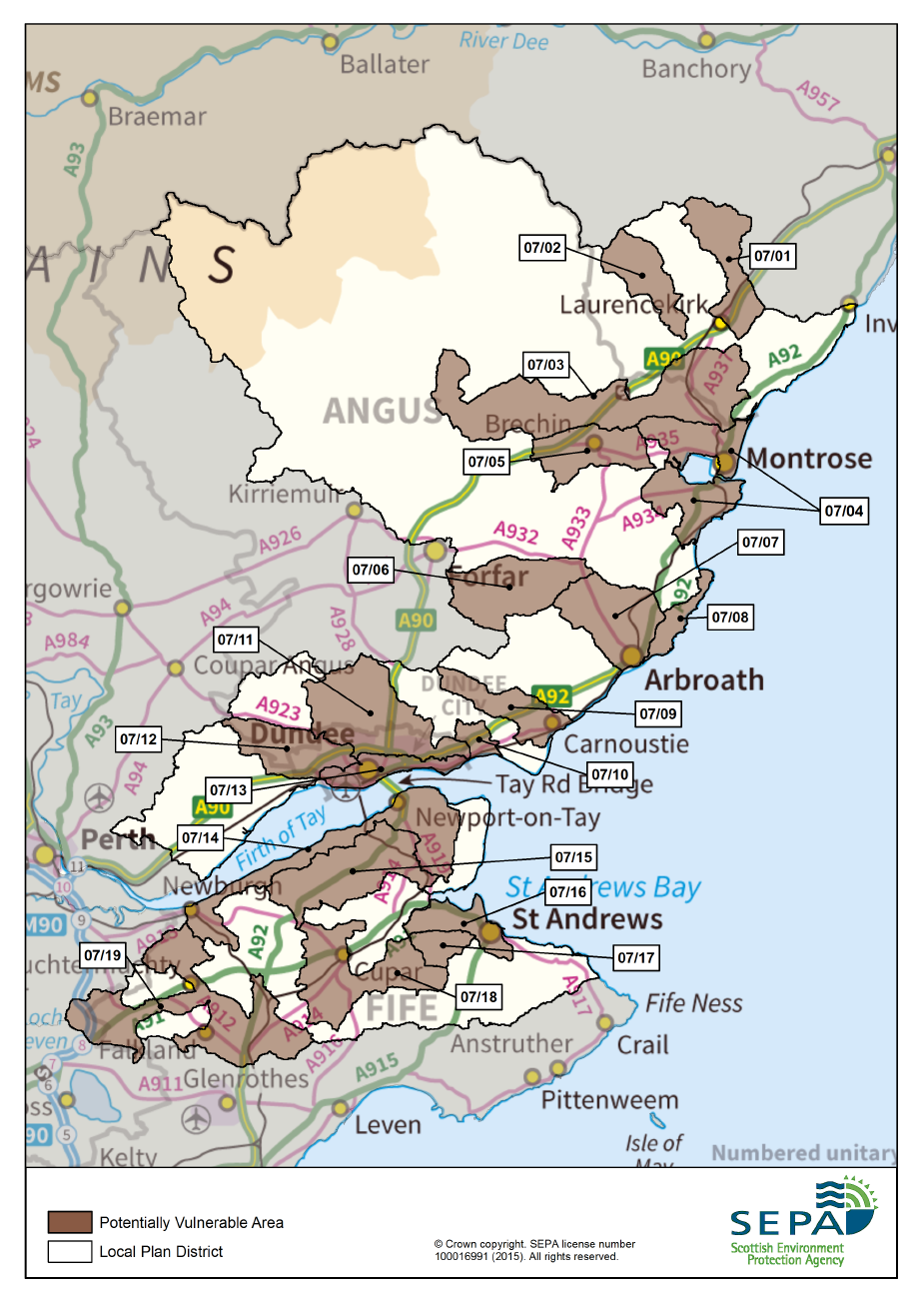
Tay Estuary and Montrose Basin Local Plan District
Scotland has been separated into 14 Local Plan Districts for flood risk management purposes. These districts are based on river catchments and coastal areas which cross administrative and institutional boundaries. Flooding demands a collaborative and coordinated response from the organisations and individuals, as flooding is best understood and managed as a natural process. A piecemeal response will not work.
SEPA, working with others, has produced a Flood Risk Management Strategy for each Local Plan District. The Strategy describes our agreed ambition for managing flooding and the priority of actions to be taken forward to deliver this. A Local Flood Risk Management Plan will also be produced, prepared by the local authorities within each district. The local plan provides additional detail on the local responsibility, funding and coordination of actions. Taken together, these documents are the single point of reference for the public in describing the response and commitment of public bodies to address flooding.
The Flood Risk Management Strategy is made up of three sections:
Section 1: Background information on the approach taken to managing flooding in Scotland.
Section 2: This is the main focus of the Flood Risk Management Strategy. For priority areas within each district (called Potentially Vulnerable Areas) there is a description of the causes and consequences of flooding; the agreed goals or objectives of local flood risk management; and the specific actions that will deliver these actions over the short to long term. View Potentially Vulnerable Areas
Potentially Vulnerable Area
- Laurencekirk (07/01)
- Fettercairn (07/02)
- North of Brechin (07/03)
- Montrose Basin (07/04)
- Brechin (07/05)
- Lunan Water (07/06)
- Arbroath (07/07)
- Coast North of Arbroath (07/08)
- Carnoustie, Barry (07/09)
- Monifieth (07/10)
- Downfield and Dundee (07/11)
- Invergowrie (07/12)
- Dundee and Broughty Ferry (07/13)
- Tayport and Newburgh (07/14)
- Lucklawhill (07/15)
- St Andrews to Guardbridge (07/16)
- St Andrews (Denhead and Strathkinness) (07/17)
- Cupar (07/18)
- Auchtermuchty and Pleasance (07/19)
FRM Strategy – all sections (25MB)
